A GPS: what's it for?
A GPS is a receiver that converts signals from satellites into a geographic position. Globally, gPS tells you where you are . With the exception of a few nuances, nuances translated by acronyms such as WASS or EGNOS, which should be integrated before buying a GPS.
Lexicon to understand a GPS
GPS Global Positioning System
GLONASS Russian acronym translatable by Global Navigation Satellite System
GALILEO Future European Positioning System
HPB differential GPS
WAAS : American differential
EGNOS : European differential
MTSAT : Japanese differential
The GPS network
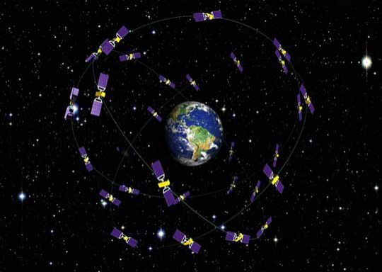
The system is based on a constellation of 30 satellites in low orbit (between 20,000 and 20,500 km), which they cover in just under 12 hours. This mesh which covers the entire globe (including the poles) makes it possible to have a dozen satellites permanently above you.
The position is obtained by calculating the distance between the receiver on board the boat and the satellite, a calculation that is repeated on several satellites. Satellites send the time of transmission by waves (microwaves) that travel at the speed of light. Knowing this speed and the time difference between the time of transmission and the time of reception, the distance between the receiver and the satellite is determined. This information multiplied over several satellites determines a position.
GPS competitors
GPS is an American system open to the public but remains the property of the state. To get out of this yoke, the Russians developed their own system called GLONASS, which is currently in operation. Europe with GALILEO is also developing its own coverage, which, following financial setbacks, is not expected to be operational before 2019 .
As an example, the Garmin Quatix 3 GPS watch has an antenna capable of receiving GPS and GLONASS signals.
GPS position accuracy
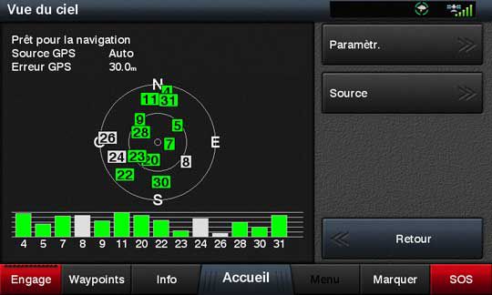
At the launch of GPS, in order to reserve a high level of accuracy for its military, the American defense has voluntarily degraded the GPS signal by offering an accuracy of 100 m for civilian users. But because of its uselessness, this restriction was lifted in 2000. For safety, the accuracy of the GPS is announced within 10 to 20 m (although it is often better). However, the quality of the position is not specified. It's hard to tell when the GPS is disrupted or not.
The differential to improve quality
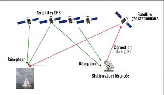
The differential is there to refine the GPS position and especially to avoid fluctuations in accuracy and ensure quality of service. The principle is simple. A ground station whose position is precisely known, picks up the GPS signal and calculates the position error. In less than 5 seconds, it sends this error back to a geostationary satellite, which can then inform users of the error at time T for that area.
With a differential, the accuracy falls between 3 and 5 m, less than the length of your boat! The precision and regularity of the position means that this system is now on board aircraft that can land without visibility, the altitude having been greatly improved..
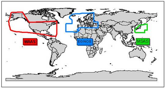
There are 3 differential systems in the world but fortunately all of them are compatible (which will save you from changing GPS when you change zones!). WASS covers the United States, EGNOS covers Central Europe and MTSAT (or MSAS) is over Japan.
On our GPS units, this means a menu setting, which can be activated or not (at your choice). The latest GPS devices all have this option.


