It is obvious that we cannot make definitive forecasts simply by observing the sky, but clouds are an interesting and complementary indication of barometer observation and temperature. They allow us to follow better the meteorological evolution of a given situation without however replacing the marine weather reports.
We know that hot air tends to rise. Thus a warm air mass under a cold air mass will be unstable since there will be continuous exchange of cold particles that want to go down and hot particles that want to go up. We then observe clouds with strong vertical development of the cumulus type. However, a cold air mass under a warm air mass will be stable and cloud formation will only occur during a general cooling of the air mass. We then see stratus clouds in the form of successive layers.
In fact, an isolated cloud is not itself a characteristic of a given meteorological situation, but rather the succession of clouds with the concordance of a change in barometric pressure and temperature can predict this or that type of weather. In fact, cirrus clouds are often found in very pure anticyclone skies without announcing the arrival of a disturbance. Similarly, in stormy skies, we find almost all types of clouds without causing a significant deterioration of weather.

In fact, cloud systems can be divided into approximately three classes.
Vacuum systems
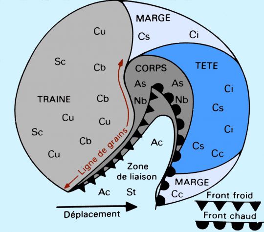
They are associated with a disturbance and therefore move rapidly. However, they retain a high degree of shape stability and are characterized by sharp cloud contours. Being generated by the meeting of air masses of different temperatures, it results in a separation of clouds due to the influence of fronts. Several parts can thus be distinguished in a low cloud system.
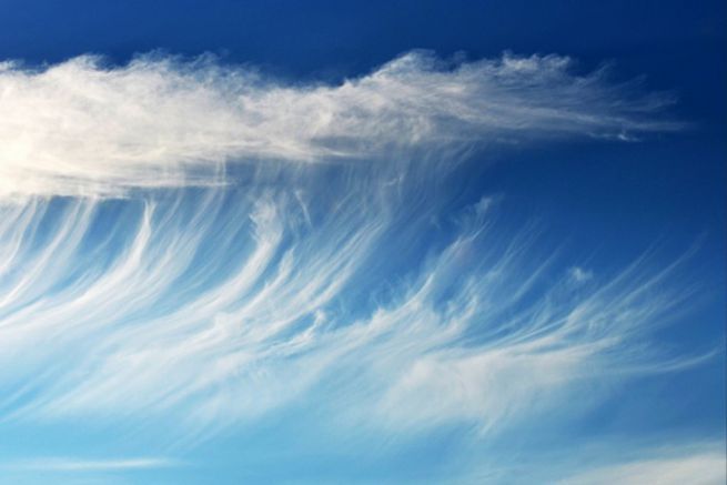
- The head The sky is occupied by cirrus and cirrostratus with sometimes some cumulus of good weather. Visibility is good, even excellent. As the body approaches, the sky becomes completely overcast and the ceiling lowers. Then the altostratus appears in the form of a greyish and uniform veil.
- The body Warm front: the posterior part of a warm front. It is thus characterized by the appearance of altostratus and nimbostratus with some shredded low clouds. The rain then appears in continuous form and visibility becomes poor or even nil.
- The grain line warm: in the warm sector, the sky is low with a continuous layer of stratocumulus and some drizzle. The arrival of the cold front, i.e. the passage of the body behind, is characterized by a fairly straight line of squalls (about 80 km), great instability of the air and therefore the appearance of cumulus and cumulonimbus. Visibility improves except under rain, snow or hail associated with strong, changing winds.
- The train It is determined by a variable time zone. It announces the end of the passage of the disturbance. However, there are still discontinuous stratocumulus and altostratus sheets as well as budding cumulus congestus and cumulonimbus clouds. Soon the sky contains only a few cumulus. Good weather returns unless another disturbance follows
Storm systems
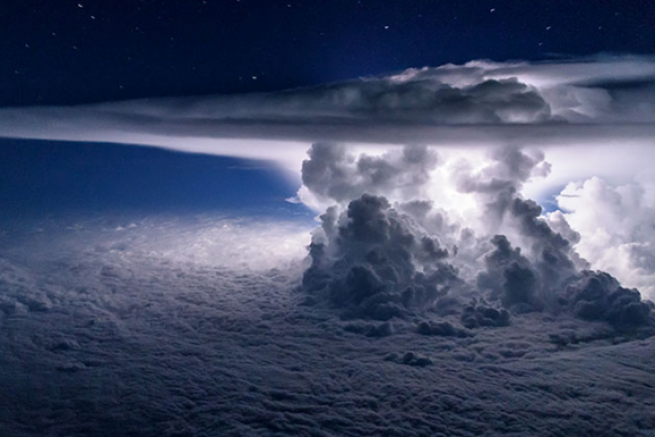
They are characterized by slow motion, rapid deformation over time, and blurred and irregular contours. Before the arrival of the storms themselves, a pre stormy sky appears with a veil of dense cirrus and cirrostratus then some altocumulus and cumulus. Then the sky becomes charged, the atmosphere heavy with cumulus congestus with very strong vertical development and cumulonimbus accompanied by violent showers.
Altocumulus systems
They are, in fact, weakened depressive systems. They are therefore observed in the lateral parts of a disturbance: body edges and connecting zones. The sky is not completely overcast, but there are isolated banks of lenticular altocumulus in perpetual transformation, sometimes accompanied by cirrocumulus.
Thus, from the observation and recognition of clouds and their association in cloud systems, we can define a type of weather and thus predict the evolution of the atmospheric situation by supplementing this information with a reading followed by the barometer and temperature.
