The Bermuda Triangle
The Bermuda Triangle is an area of nearly 700?000 km between the Bermuda archipelago, Miami and San Juan in Puerto Rico. Its reputation is infamous since hundreds of disappearances of planes and boats have taken place there. Disappearances that are all the more mysterious as they are unexplained. But it is above all a legend, since in itself, sailing in this place does not represent any danger.
The first are mentioned in 1950 in the Miami Herald . But it wasn't until 1952 that the reputation of the famous triangle was born. An article in Fate reports the disappearance of a squadron of five fighter-bombers off the coast of Florida on December 5, 1945.
Scientists have tried to justify these disappearances. Recently, the documentary The Bermuda Triangle Enigma revealed the presence of rogue waves within the Triangle. This extremely powerful natural phenomenon forms a wall of water about 15 m high with a pressure far greater than a ship can withstand.
Discover the Bermuda Triangle Theory
The 40 e Roaring
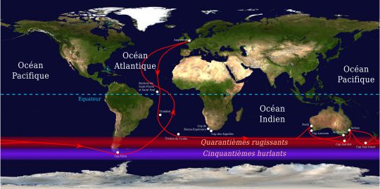
This is the name given by the sailors to this zone located between the 40 e and 50 e parallels. This region in the southern hemisphere gets its name from the strong winds that come mainly from the west, which it hosts. The sea is also particularly rough, especially in the Southern Ocean (south of the Indian Ocean). These difficult conditions are due to the lack of land to break the waves and slow down the wind.
This very southerly route was discovered by the Dutch navigator Hendrik Brouwer in 1610 as the fastest way to cross the Indian Ocean. The prevailing westerly winds at this latitude made it possible to reduce sailing time, even though it was dangerous. This route was later used by clippers (fast merchant ships carrying perishable goods) for trade between Europe, South America and the Orient.
The 50th screamers
We're talking about latitudes between the 50 e and 60 e parallel, in the heart of the Southern Ocean. Even further south and in close proximity to Antarctica, the winds and seas are even more violent. There is a saying "at 40 degrees, there is no law, but at 50 degrees, there is no God."
The temperature difference between ice and water generates many depressions. Not to mention the drifting icebergs which can be formidable in navigation.
Cape Horn
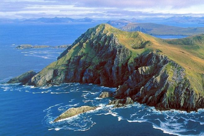
Cape Horn is a cape located at the southern end of Horn Island in the Tierra del Fuego archipelago, at the level of Chile. It is the southernmost point of South America. It is also the southernmost of the great capes and it marks the border with the north of the Drake Passage (arm of the sea that separates the south of South America and Antarctica).
Cape Horn is a 425 m high cliff, located on an island 6 km long and 2 km wide. A sculpture of albatrosses stands there in homage to the sailors who died trying to round this famous cape.
For years, it has been a crossing point for trade routes between Europe and Asia and today it is an essential crossing point for major round-the-world sailing races (Vendée Globe, Jules Verne Trophy...). Today, commercial vessels favour the Suez or Panama Canal.
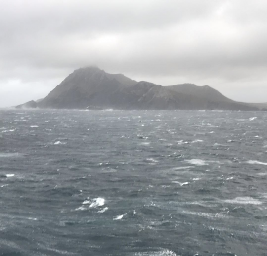
Yet it is one of the world's most dangerous passages for shipping. Located near the Southern Ocean (in the heart of the 50 e howling), it is subject to strong winds, heavy storms and stormy seas. Winds are accelerated at the cape by a funnel effect created by the Andes and the Antarctic Peninsula.
If the ice edge begins further south of Cape Horn, the danger remains icebergs. If in winter it does not rise above 50° south in the Pacific Ocean, in summer they can be 40° south.
All these dangers that make rounding Cape Horn particularly difficult have given it its reputation as a graveyard for sailors. It is also known as the "Hard Cape", the "Dreaded Cape" or the "Cape of Storms". In the world of sailing, it is compared to the ascent of Everest.
The Bay of Biscay
The Bay of Biscay suffers from a bad reputation, yet it is an obligatory passage to reach Spain. This part of the Atlantic situated between Brittany and the Cantabrian coast (in the north of Spain) covers an area of 223?000 km2.
It is traversed by strong north-westerly winds from the low pressure areas centred on the British Isles and the North Sea, combined with the Azores High. The southern part of the Gulf is also known to have the biggest swells in the Atlantic. At the mouth of the Adour River at Anglet (a river in the Aquitaine basin), waves formed several thousand kilometres away can reach 6 to 8 m in height.
The difference in depth on reaching the continental shelf also generates a very large swell.
The Doldrums
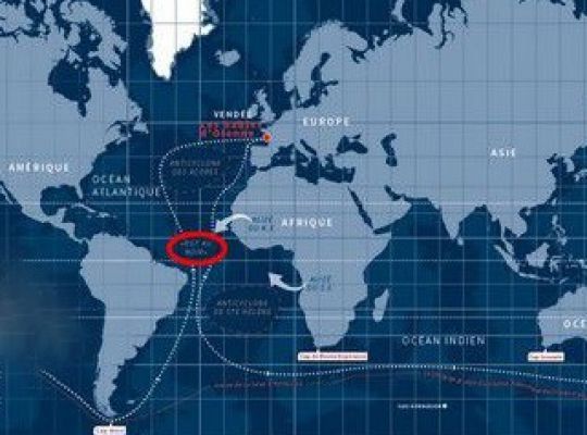
The Doldrums, known as the Inter-Tropical Convergence Zone (ITCZ), is located between 8° and 3° North (around the Equator). It corresponds to a very unstable meteorological zone. Sailors who pass through it can get stuck in calm zones or, on the contrary, suffer violent squalls.
At the time, sailors were terrified of being trapped there and dying. Sick men, like animals, were thrown overboard to prevent the spread of disease on board, without any means of treatment.
