Sometimes dramatic consequences
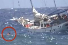
Summer storms and their violent winds can leave a heavy toll in their wake. We all remember the stormy episode of Miguel in June 2019, during which the SNSM (French national lifeboat rescue service) was plunged into mourning. Three rescuers died off the coast of Les Sables-d'Olonne (Vendée) after their launch capsized while assisting a fishing boat whose sailor was missing.
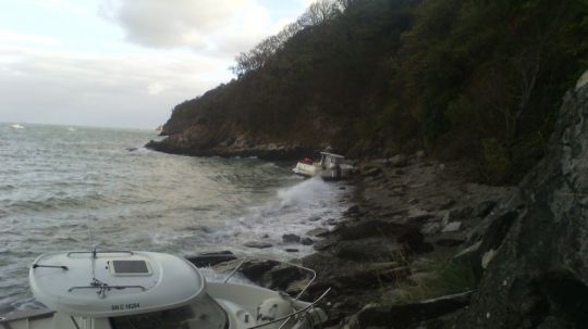
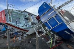
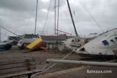
Less seriously, many boats broke their moorings and were driven ashore. Finally, the Seine-Maritime prefecture had the Rouen Armada quays evacuated to avoid accidents.
In August 2023, the French coast is once again hit by a storm, a reminder of the importance of being prepared for such events.
An unusual situation
In France, as we've all noticed, the most favorable season for storms is between October and March. During this time of year, stormy lows develop over the North Atlantic in upper-level jet streams, also known as disturbance tracks.
What's more, at this time of year, the jet stream is on average stronger and closer to the European coast.
This explains why a summer storm that hits our Atlantic coast - like Miguel in June - is much rarer.
In fact, during the summer :
- The jet stream is generally weaker and undulates further north.
- North-south thermal contrasts are less marked than in winter on the Atlantic, generating less energy.
- Subtropical high pressure moves further up over southern Europe, forming our summer anticyclone.
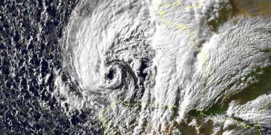
So how do you explain a summer depression like Miguel's?âeuros¨
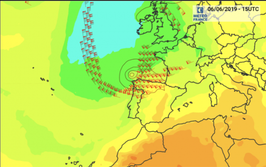
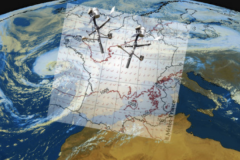
Temperature record at 850 hPa (illustrating thermal contrasts), the barbules show the upper-air jet stream (around 100 knots at 12 km altitude on the eve of the storm) to the northwest of Spain. The Miguel low deepens under the jet, between 06/06/19 at 0 h UTC and 07/07/19 at 18 h UTC - © ECMWF, Météo-France.
Météo France points out that the disturbed situation that gave rise to this storm is explained by a low geopotential anomaly (a constant pressure level corrected for local variations in gravity) over the near Atlantic.
This situation is combined with colder-than-usual air masses, in contrast to the warm air over the Canaries. This zone of strong large-scale eddies with significant temperature differences is contributing to the very significant strengthening of the jet stream to the north-west of Spain, favouring the deepening of an unseasonably large low-pressure system.
Why is this type of storm a riskâeuros situation?
The sea state will be relatively similar between a winter and a summer storm.
On the other hand, port facilities are put to the test more severely, with far more boats in summer than in winter.
Statistically, the risk of accidents at sea is higher due to the greater number of boaters in summer. To this we can add that year-round sailors have better-prepared boats and are themselves more experienced.
Precautions to take
In port :
- Even if it's summer, don't take weather warnings lightly.
- Many specialized weather websites are free of charge, so don't hesitate to consult them daily.
- Before leaving your boat, moor it up and defend it as if a storm could pass through, even in summer.
- Only set sail if you feel that your boat, its equipment, your skills and those of your crew are sufficient for the expected wind and sea conditions.
Offshore :
- Check your boat's sail reduction systems and safety equipment. Find an opportunity to try them out at sea.
- If you don't have a forestay to hoist a staysail, give your boat this gift. In strong winds, the sailboat's behavior will be much healthier than with a half-rolled genoa.
- Don't rely on the emergency services: they risk their lives every time they intervene.
Summer storms: previous major events
Storms or strong gales in June or summer are rare phenomena, but have occurred in the past. However, you have to go back more than 30 years to find comparable episodes:
- July 6, 1969: a storm hits Brittany, Normandy and the Paris region, with 166 km/h recorded in Brest
- June 26, 1958: a more southerly trajectory.
- June 16, 1965: storm over the northern half of the country, including Ile-de-France.
- Very low-pressure situations also occurred on June 9 1954, July 12 1961, July 3 1988, August 7 and 8 1948...
- On June 7 1987, a line of thundery squalls triggered a stormy gale. Wind speeds of 126 km/h at Biscarrosse and 115 km/h at Bordeaux were recorded.
Source Meteo France


