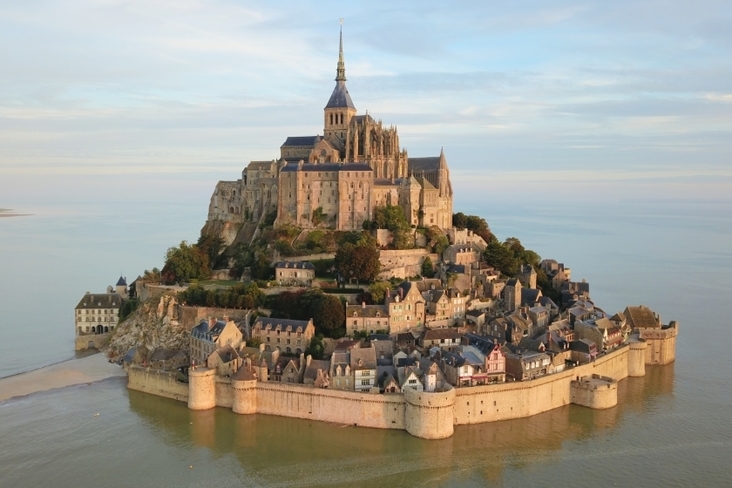
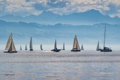
The Bay of Mont-Saint-Michel is known for its highest tides in Europe. The bay brings together a strong diversity of natural environments, making it the largest French expanse of salt meadows and polders. Pearls in its middle the Mont-Saint-Michel and the Chausey archipelago
This walk is to be done taking into account of course the distances and the tides. In fast waters, the tidal range is close to 15 metres! The current is very strong and not always as we would like it to be, but it is worth the detour.
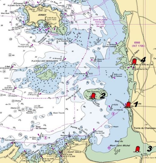
1 - Granville
The yacht harbour of Hérel- Granville is a modern port with tidal access. It is a very welcoming port and is the ideal starting point for our little trip.
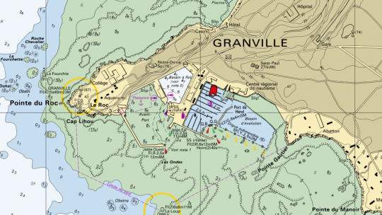
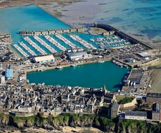
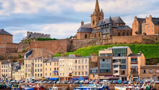
Perched on its rock, Granville forms a beautiful picture with its Upper Town of granite houses surrounded by ramparts and its fishing and yachting harbours.
Formerly a cod port, the town lived for several centuries to the rhythm of the fishing campaigns. Ships were also armed for the Grand Pêche in Newfoundland and Saint-Pierre-et-Miquelon or by privateers for the Wars of the Races. They contributed greatly to the prosperity of the City from the 16th to the 19th century.
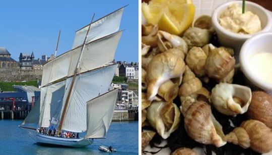
Today, Granville is the first French shellfish port. The whelk, an emblematic product of the West Cotentin, being the most fished in the bay.
To see, to do
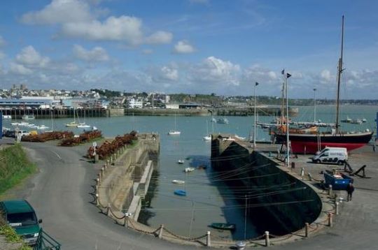
- The point of view at the top of the town which you will access by taking the drawbridge near the fishing port while passing by the old form of refit. From the top of the city, paths will allow you to go around the Upper Town, to walk on the cliffs of the Roc and to admire the islands opposite.
- The form of refit built of Chausey granite blocks assembled in a dovetail shape, it has the appearance of a long corridor of bleachers ending in a hemicycle.
- The Upper Town is the historical site of Granville: it was the English who were at the origin of its creation in the 15th century. The construction and reconstruction of the fortifications will extend over several centuries. The ramparts of the Haute-Ville extend over 450 metres long and a hundred metres wide. Walking around it is the first thing to do when you arrive.
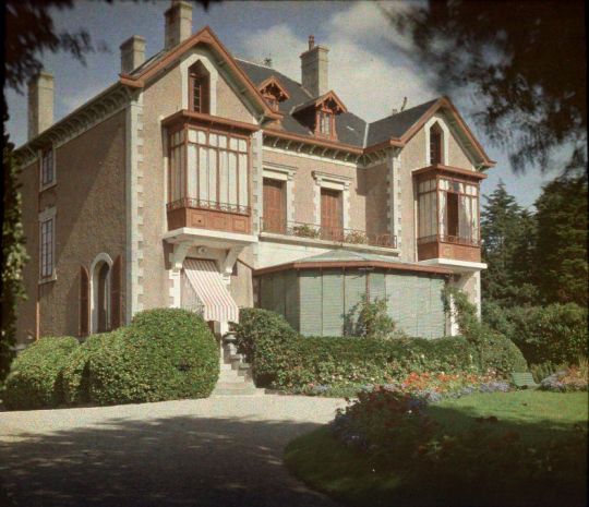
- The Christian Dior Museum ...overlooking the sea. This museum is housed in the former villa "les Rhumbs", childhood home of the famous couturier. Exhibition "Itinerary of a couturier" through the museum's collections. Nearly 100 haute couture models and accessories.
2 - Chausey Archipelago
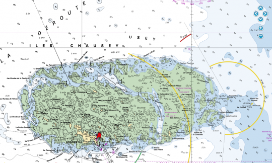
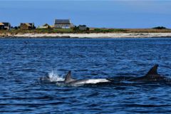
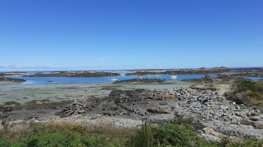
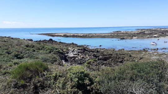
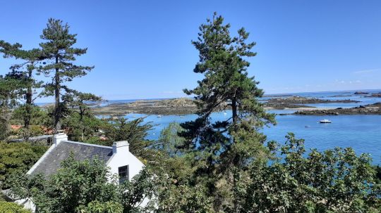
Chausey is an archipelago out of the ordinary. Sailing in Chausey is a sailor's privilege as this fragile setting is so sensitive. At low tide there are 365 islets and only 52 at high tide..
From Granville, navigation does not present any major difficulties. It is good to pass to the South of the Bass Videcoq and to make road towards the entrance of the Sound of Chausey. The lighthouse is an excellent landmark.

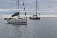
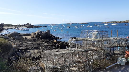
In Chausey you can anchor at the embossing on the buoys provided. Beware of the current which sometimes exceeds 4 knots and which complicates the manoeuvre a little... It is sometimes easier to reach the BM slackwater when the current is at its weakest, or even nil, the Sound being closed in its northern part.
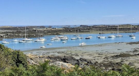
The Sound, what is it?
This word originates from the Nordic languages. "Sund" in Scandinavian can be translated as channel. Oriented NW/SE, length of a ½ mile, width from 100m to 400m depending on the location the Sound is a very good anchorage at low tide, but can be less comfortable in the water because of the current and the swell that can enter it.
To see, to do
- Beaches . The water is transparent, the sand white and fine. Even the most reticent will want to swim! Chausey has six beaches, three of which are large enough for swimming.
- Marin Marie's house . Marine painter and navigator, Paul Marin Durand Couppel de Saint-Front dit Marin Marie considered Chausey as his home port. He bought a house there at the foot of the chapel, the first one you see when you arrive.
- The lighthouse . Commissioned on October 15, 1847, it is located on the southern tip and rises 39 meters above the highest seas. The lighthouse has been listed as a historical monument since 2009.
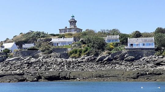
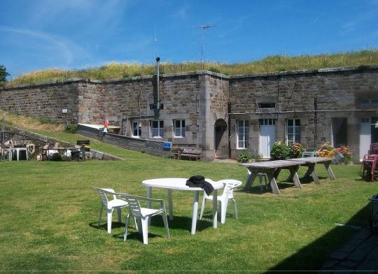
- The fort . Wanted by Napoleon III and completed in 1866, it housed prisoners during the First World War and a small German garrison during the Second. Today the fort's casemates are inhabited by fishing families.
Stroll through the archipelago
To understand and discover the archipelago and its 365 islets, one per day for one year, I propose a first walk from the Sound to Port Homard. A walk to do at the end of the ascent to have water to escape from the Sound to the North and enjoy the beginning of the ebb in the Beauchamps channel and have enough water to reach Port Homard, but not too much to see the rocks... Nice equation!
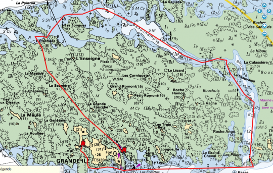
The exit of the Sound from the North does not pose any particular problem, as the markings are dense and perfectly legible. Nevertheless, given the current, great vigilance is required as well as a perfect knowledge of the water heights expected during the trip. Map and GPS or even binoculars will remain at hand.
From the Sound to the entrance of the Beauchamps channel some stones to avoid..
The channel is much more peaceful because it is wider, watery and well marked. Beware at the exit, the isolated danger beacon, La Tournioure, has lost its warning lights which makes it less visible.
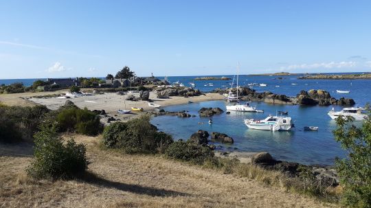
All this walk allows you to spot a number of small, well-sheltered anchorages for the next few times.
After that full W towards the rocks of Brittany, south of the point of the same name respecting the beaconing then up towards Port Homard passing between the Grande Ile and the Petit Epail. The depths are quoted between + 2m and + 4m. In neap water this anchorage stays afloat quite high towards the coast.
3 - Towards Mont-Saint-Michel
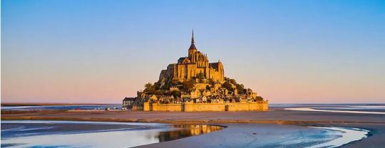
Who hasn't dreamt of going to Mont-Saint-Michel with their own boat or even spending a night there, at anchor? Feasible, but not easy!
Indeed the bay of Mont-Saint-Michel is rated between +0 in its northern part and +12m in its southern part towards the Mont. It thus requires significant tides to be able to approach with at least PM at 13m, i.e. coefs of 95, probe reported in Granville.
Note that the zero probe is located 7 miles from the Mount, which complicates navigation. It is therefore recommended to have a shallow draught boat or even a dinghy. Leaving Chausey, head towards the Pointe de Champeaux located to the east of the bay and head towards the Tombelaine rock. It is on this trajectory that you will find the most water. Arriving by the East of the Mont with the end of the stream, sail, admire and leave before you find yourself stranded. The sandbanks are playful and move..
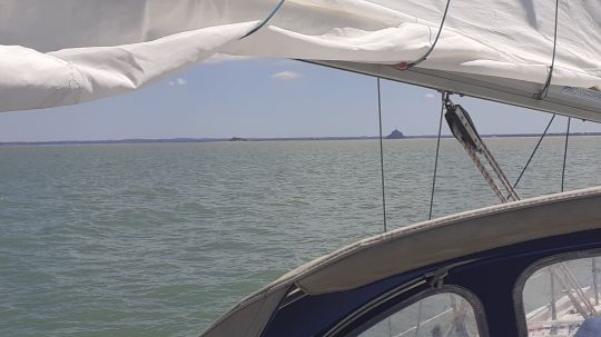
For our part, due to the lack of wind at the start in Chausey, we arrived too late and unfortunately could only get a little closer. Party postponed, next time we spend the night there.
4- Regnéville Harbour
Between Carteret and Granville, the dune coastline is punctuated by 8 estuaries called "havens" where small streams flow into the sea. Formed over the millennia by the rising and falling waters, erosion and sand accumulation, these harbours are more or less important. They develop particular forms with sedimentation by gravel or fine sand and mud that are conducive to the creation of salt meadows.
The word harbour comes from the Norse (Viking language) "häfn" which can be translated as shelter, translated into English as "haven" and then "harbour", the port in the current sense.
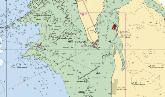
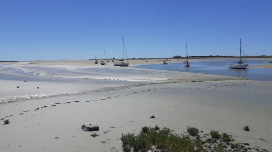
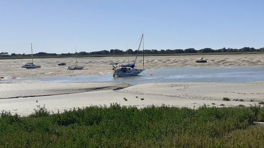
These harbours are very safe shelters from wind and swell. The harbour of Regnéville has been a stranding port since the Middle Ages. It reached its peak in the 19th century with the lime trade, the inshore fishery and of course the Newfoundlanders.
You have to arrive at PM paying attention to the water level. Grounding is the rule, but without a crutch. Indeed the tides are peculiar because of the sandbanks at the entrance and cause strong currents and whirlpools.
During our last trip there we were surprised to find that at PM-5 there was still no water around the boat. It arrives all of a sudden and in one hour you have the 2 to 3 meters of water coming in. Guaranteed current! It is therefore preferable to come aground with keelboats or dinghies.
To see, to do
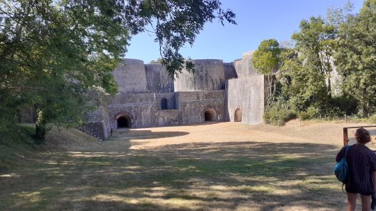
The lime kilns of the Rey. They form an exceptional complex that bears witness to the industrial past of Regnéville-sur-Mer. Built in the 19th century, the four large kilns supplied lime to the West Armorican countries. The lime kilns will only remain in operation for about thirty years, but they will bring to Regnéville an important and prosperous industrial activity.
Article written with the precious complicity of Cabotage in Brittany , Manche-Normandie page
All the cartographic backgrounds come from data.shom.fr Geodetic system: WGS84
