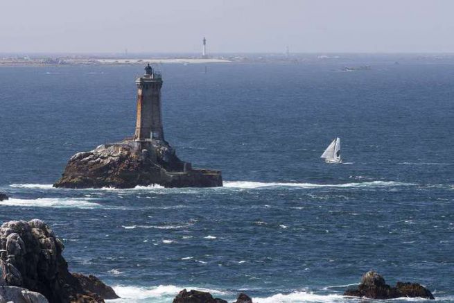
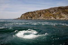
Between the long breast pavement (about ten miles) and the tip of the raz surmounted by a semaphore, the passage of the Sein raz allows you to enter or leave the Iroise Sea
For those who would like to go to northern Brittany or the Channel Islands, we do not recommend passing through the Armen lighthouse to the west of the breast road. The strong ferry currents will certainly attract you to this famous roadway. Moreover, offshore, the swell is rarely favourable
It is therefore more prudent and quicker to use the land passage, the Raz de Sein. If we take a few precautions, navigation is quite accessible. Indeed, the passage really subject to the current is relatively short (4 miles), it is quite wide, and above all there are few hidden rocks.
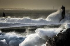
However, the passage of the Raz de Sein is not to be taken lightly, as the current of 6 knots of strong water will lift heavy seas as soon as it opposes even moderate winds.
Feel free to refer to this article on the Raz to know the good practices to be implemented during these delicate passages.
We'll arrange to arrive at Raz de Sein at the time of the slack. In case of delay, care must be taken to have the current in the same direction as the wind. Thus we move on to the open sea slack with a NW to NE wind and the low sea slack with a SW to SE wind.
The hours of the reversal
The considerable bodies of water that must pass through its rocks are slightly out of step with Brest's tidal hours. The rising tide starts 20 minutes before the Low Sea of Brest while the falling tide will start 45 minutes before. The actual display will last about thirty minutes.
The direction of the currents
The currents are mainly towards the NW for the rising tide and towards the SW for the falling tide.
However, there are some local subtleties where the current does not carry exactly in the general direction (red arrows).
The counter-currents are numerous and powerful.
The image below shows in orange the main counter-currents of the breast raz.
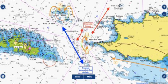
1- At rising tide north of the Vieille and 0.5 miles from it, a counter-current flows into the lighthouse. To avoid it, we must stay 0.5 miles from the lighthouse.
2 - At ebb tide south of the Old Town and still 0.5 miles away, a counter-current carries over the lighthouse and its rocks. We always stay 0.5 miles from the lighthouse to avoid this counter-current.
3 - From Audierne to Pointe du Raz (9 miles), along the coast, the rising tide begins 2 hours before the BM. This is very useful to get to the Raz, especially since this current can reach 2 knots in white water
4 - Tevenec is a danger to be avoided from a distance, it is said that the currents are on the rock. To its East and West two counter-currents will bring you back to the lighthouse.
Waiting anchorages
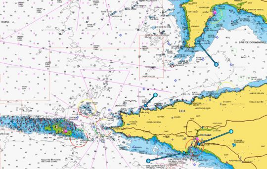
To the south of the raz, there is Audierne (1), but not always accessible due to the tide. We will then choose the anchorage St Evette (2). Beware of the rocks of the Gamelle which present a strong danger when coming from the west.
To the north of the raz, Cap de la Chèvre and more precisely Anse Saint-Nicolas (4) will be the only relatively safe shelter in a westerly wind. But the distance of nearly 15 miles is not very attractive. If the wind and sea are calm, a waiting shelter can be found behind Pointe de Brezellec (3) east of Pointe du Van (2 miles).
