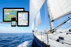
The Maxsea company, which developed its Time Zéro software available on PC and iPad, has been working in secret for 2019 on a new project: the development of its own digital cartography! Until then, the market was divided between 2 players in this field: Navionics, now owned by Garmin, and C-Map, owned by Navico, both manufacturers of electronic navigation equipment. For its part, Maxsea, part of Furuno, felt that agreements to use one of these two mapping systems could be terminated at any time. Hence the desire to break free and stand on their own two feet.
Creating the TZ Maps cartography was an enormous undertaking, requiring agreements with every hydrographic service in every country to draw up the new charts. Supported by 4 full-time in-house cartographers, the result is spectacular. In fact, as we've come to expect, Time Zéro is breaking new ground in a field where we thought we'd done it all.
Raster-like maps
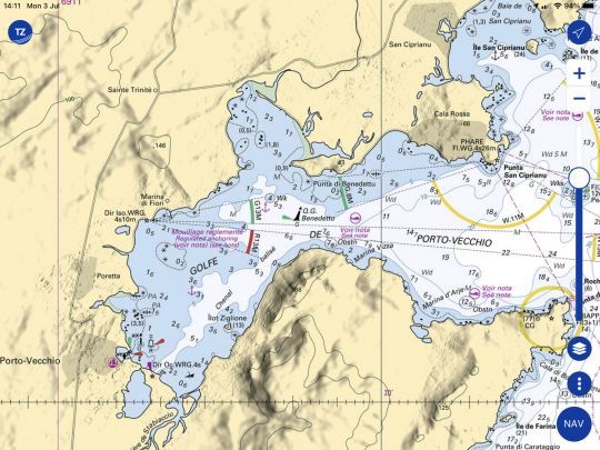
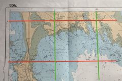
Raster charts are scans of paper charts. Regular navigators appreciate them for their detail and color. For these users, TZ Maps has thought of reproducing the colors of these paper charts on the vectorized version. As a result, charts can look like SHOM, Admiralty, NOAA or even... competitor Navionics charts! By adjusting the menu, you can find yourself back in the world you're used to navigating in.
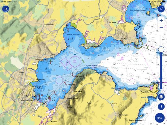
Note that if the colors change, so do the icons for buoys, lighthouses and landmarks. By choosing the SHOM color theme, for example, you're completely on a vectorized SHOM chart. The result is quite stunning.
Downloadable tiles
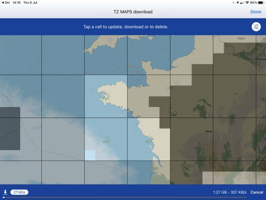
All maps are available online, in streaming mode. This ensures that you'll always be sailing with the latest updated charts. But if you're sailing outside network coverage, you can also load a map zone. This is represented in the form of a "tile", which can be loaded or unloaded from the device's memory at will. Depending on the information you choose to load - vector maps, raster maps, high-resolution bathymetry - the weight of the downloaded file varies.
It's very easy to use, and takes just 10 seconds to load a tile in 4G. So it's very quick.
High-definition bathymetry
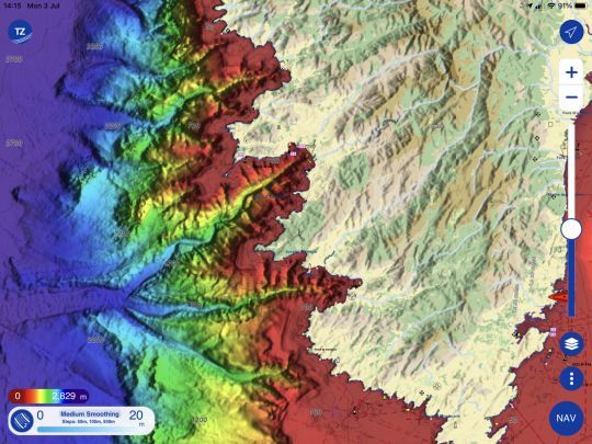
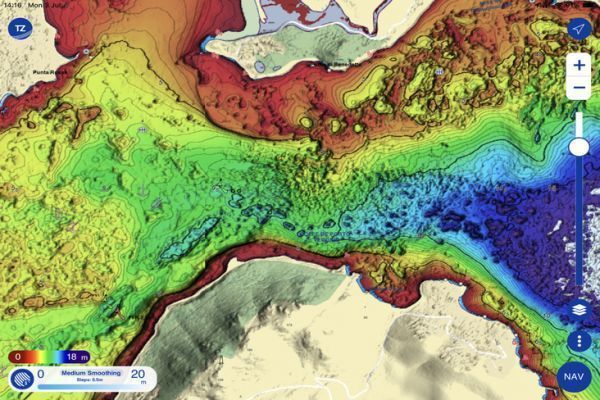
With TZ Maps, both bathymetry and altimetry are vectorized data. As a result, the software is capable of displaying information according to the user's parameters, but above all of playing with colors to make them very clearly legible.
In this way, the seabed is mapped in high definition, and color palettes are used to give it depth on screen. Fishermen are very fond of this mode, and are accustomed to identifying fishing zones by color changes.
Modifiable maps
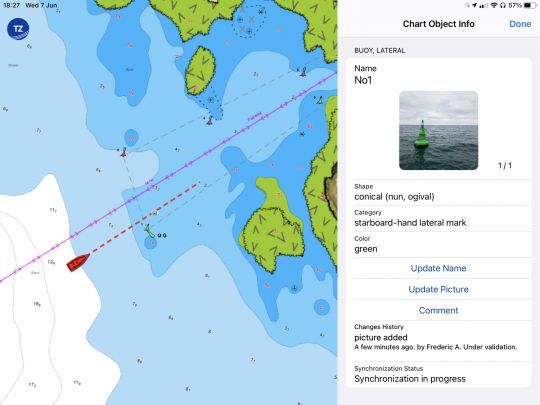
The quality and accuracy of the maps can only be verified by navigating and practicing. TZ Maps can be added to by users. In practice, this can be seen by moving a fairway buoy, for example. The old position remains visible on the map, but in a layer that you can choose to display or not, you can see the buoy's new position. This information is passed on to TZ Maps' cartographers, and if validated by a large number of users, is then updated in the cartography. In this way, the quality of the map is not fixed and can be improved with user feedback. A bit like what we know in the automotive world with community applications like Waze.
Other information, such as notices about ports and facilities, completes this community system.
An incredible search engine
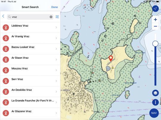
How do you find a cove or look for a rock on a map? TZ Maps provides the solution, having entered all the names present on the map into its database. Searching for a beacon or a reef becomes child's play by entering the Smart Search menu. Just by typing the beginning of the name, the application pulls up all the possible solutions. It's simple, fast and precise. To date, no other marine mapping software has offered this not-so-innovative, but very practical function.
Flashing headlights
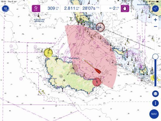
Flashing lights on the map to the rhythm of the models in place on the coast is very practical for navigation, but not really innovative. This time, however, TZ Maps shows the range of headlights, indicating when they are hidden by a piece of land or at the end of their range. So, depending on your boat's position, you'll know if you're within the lighthouse's range cone, and can easily spot it on land.
Dynamic anchorages
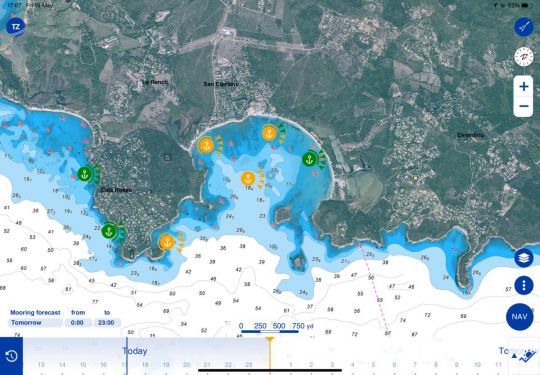
When it comes to mooring applications, Navily takes the lion's share. It indicates anchorage protection according to wind conditions. But it doesn't offer a dynamic weather display. TZ Maps now does. This application always loads the weather forecast in the background. So, depending on the time line at the bottom of the screen, it can announce whether an anchorage will be protected or not.
Coverage and rates
TZ Maps can now be used in conjunction with the TZ iBoat application. This is available free of charge on iPhone and iPad. An Android version is planned for the near future. In October 2023, TZ Maps will also be available on PC with Time Zéro software.
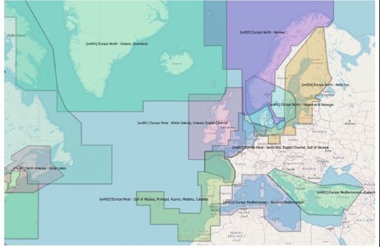
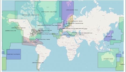
Today, this mapping covers the majority of boating areas. This coverage is constantly increasing, following negotiations with hydrographic services.
Card prices vary according to the zone concerned. Annual subscriptions range from 19.99 euros to 92.99 euros. For example, the French Atlantic coast is available at 40.99 euros/year. The same applies to the Mediterranean coast. Exactly the same price as competitor Navionics cartography...
